This walk of 7.5miles (4 hours) provides some of the best views in Mid Devon but at the cost of some steep climbs. It is not for the faint-hearted, says Tom Davies.

To minimise the amount of climbing I recommend using two cars, leaving one at the finishing point in the village hall car park at Stockleigh Pomeroy (point O on the map) and the other at the starting point at Raddon Top (point A on the map) thus avoiding the severe climb of more than a mile between Stockleigh and Raddon Top at the end of the walk.
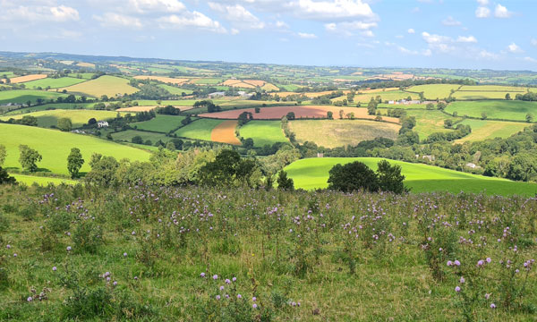
On the ridge line of the Raddon Hills there is a small car park at (A) from which a clearly marked footpath heads east along the ridge, affording spectacular views in all directions as far as the Sidmouth Gap to the south east, the Exe valley to the south, the tors of east Dartmoor to the west and a north Devon panorama.

Just beyond point (B) is the much photographed and painted wind sculpted Lone Pine, the only remaining one of several planted to commemorate men of Thorverton lost in the Crimean War (1853-1856) and a landmark in the area. The copse of 55 trees nearby were planted to celebrate the millennium in 2000 and were grown from seeds collected from the Lone Pine by the people of Thorverton.

At (B) turn left and descend the steep track heading north crossing the lane to Kitlake (where you could stop for refreshments at Wishes cafe) and then begin the long ascent along an unmetalled road to (C) on the A3072.
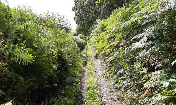
Cross the road and take the concreted farm track to Higher Burrowcombe but at (D) keep right along an unmarked dirt track past an abandoned Foden lorry. There are occasional way markers along this track but the OS map is not up-to-date and does not show a considerable number of woods and coppices along the way which were planted more than 20 years ago and are now quite mature.
Arriving at (E) take a right turn along the road and up a steep hill to the sharp bend at (F) and then up some wooden steps to the footpath which is not well used but heads diagonally across a weed-strewn field eventually meeting a farm track heading towards (G).
At (G) the farm track turns right but there is a footpath heading straight on across a field which you should take and which emerges onto the main road into Cheriton Fitzpaine through a garden!

Cross the road and you will see another footpath sign and the track crossing a steep field to point (H). Cross the road at (H) and take the footpath across another field to (I) where it joins a minor road. Turn left towards Parry Farm after which the road descends steeply to Perry Green and then rises very steeply towards point (J).
At (J) take the footpath on your left which descends into a valley and then rises into a green lane which brings you to the road passing through Chilton at (K). Turn left at (K) and after a short distance at a sharp right hand bend with a bungalow on the corner (L) carry straight on along the signposted track until you reach a farm gate.

Here there is a choice of either continuing along the field boundary or cutting across the field to (M) where there is a gate into a green lane. Walk through the green lane and over a footbridge to arrive at the A3072 at (N). Cross the road and climb the hill to the village hall car park at (O).

Click here for a downloadable map.

More from
Walks


